


Generate Architecture and Landscape Analysis Diagrams
Use a project rendering to develop graphic explanations of functional zoning, circulation, massing evolution, site relationships, exposure, sections, and layered construction.
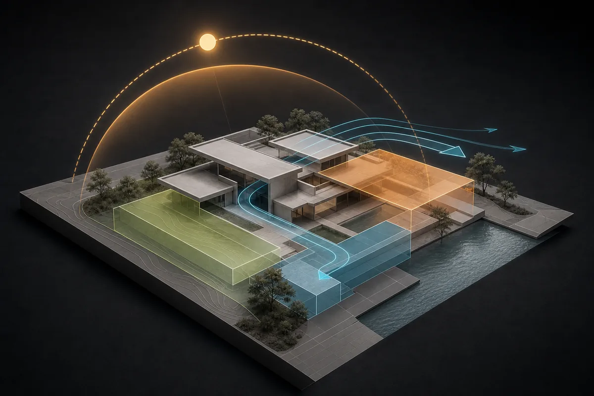
See the Workflow Run
The actual workflow — connected nodes you can run to preview each step.
Where Analysis Diagrams Add Information Beyond Renderings
Professional capabilities powered by AI.
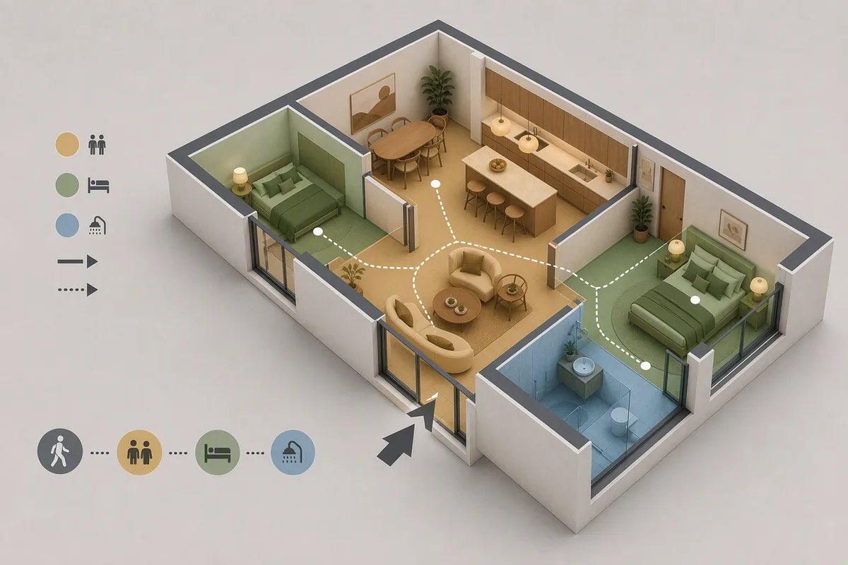
Explain Functional Organization
Show how program zones, entries, movement, and public or private areas relate across the project.
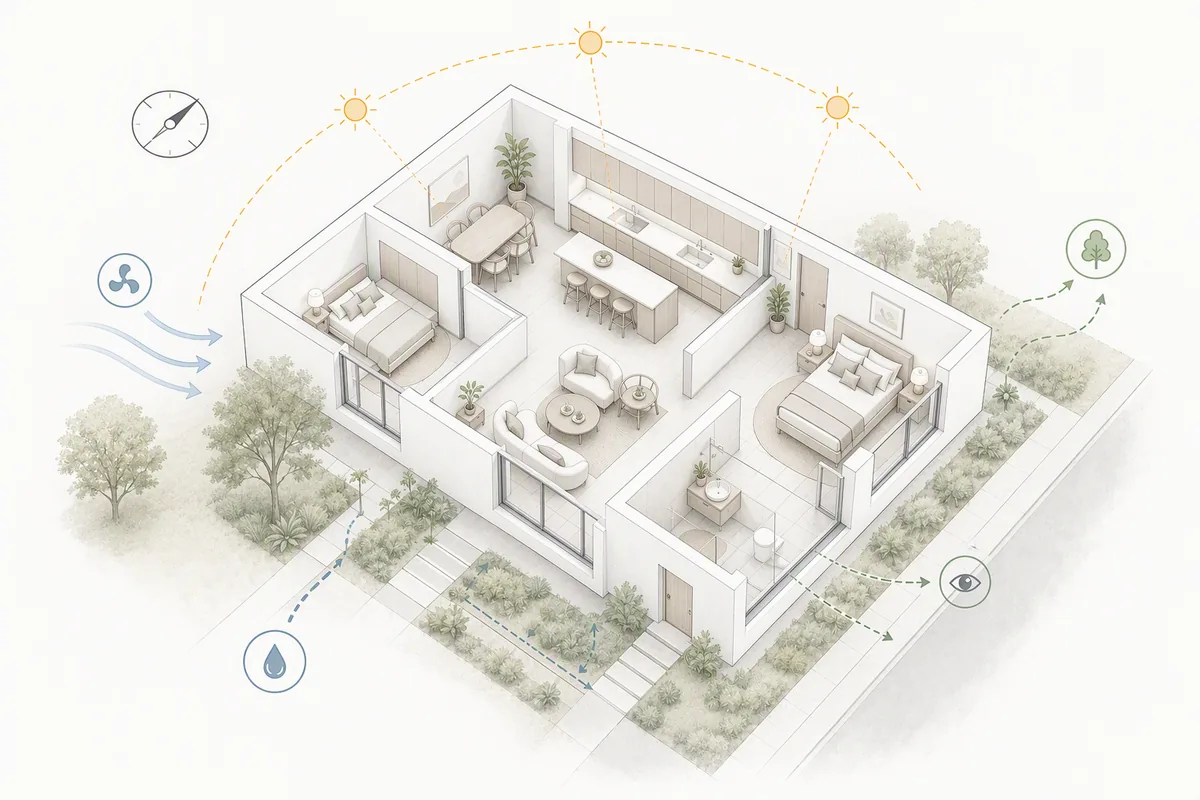
Communicate Design Development
Describe massing evolution, site response, or layered landscape and architectural strategies.
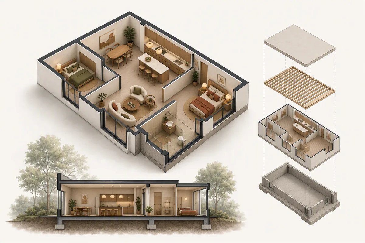
Support a Presentation or Competition Board
Give reviewers concise visual evidence of the reasoning behind the proposed form and spaces.
Choose Diagrams That Answer Distinct Questions
One diagram should not attempt to explain every aspect of the project. Separate circulation, function, environmental assumptions, and construction layers when combining them would make the graphic difficult to read.
Keep the base geometry consistent with the source proposal. Diagram simplification should clarify relationships without inventing spaces, systems, or technical performance that the image cannot verify.
Use environmental diagrams as qualitative communication unless they are based on validated analysis. Wind, solar, and daylight claims require appropriate data and professional methods.
Frequently Asked Questions
Explain What the Rendering Alone Cannot Show
Turn project form and spatial relationships into focused diagrams that support the design narrative.

Technical support: tech@promeai.pro
Business collaboration: business@promeai.pro